by Betsy Herbert
May 15, 2016
Seems everyone around the world is interested in the US primary election, especially when it comes to Donald Trump. After flying from Quito, Ecuador to San Salvador on March 12 to begin a 16-day tour of Central America, I took a taxi to my hotel.
My cab driver was eager to discuss the US presidential election. He spoke no English, but by now my Spanish was pretty good. I began by stating my opposition to Trump. As if on queue, the cabbie launched into a rant about Trump's racism. He was incredulous about the level of support that Trump seemed to be getting from American voters. I explained that US politics was extremely divisive and that there were plenty of people who opposed Trump for many reasons, including his racist views. I also told him I didn't think Trump would win. He seemed somewhat relieved to hear my opinion.
Looking back on my year-long trip around the world, I realized that nobody that I met, with the exception of a few American travelers, had anything nice to say about Trump. While I have more serious concerns about Trump, I know that if he were elected, international travel would become a lot more uncomfortable and unsafe for Americans.
The cabbie dropped me off at the posh Crowne Plaza Hotel in the hills above San Salvador, where I would meet my tour group. Over the next couple of weeks, we would travel through El Salvador, Honduras, Guatemala and Belize. Our guides were all native Central Americans.
Is it safe to travel here?
I chose not to travel solo in any of the countries I visited in Central America. I simply didn't know the culture or the region well enough. All of the countries I would visit have critically high crime rates, according to the US Department of State's Overseas Security Advisory Council (OSAC). While most American tourists in Central America don't experience any crime there, petty theft and pick-pocketing are not uncommon, and there have been incidents of violent crimes, including murder and kidnapping. I felt much safer traveling with an experienced tour group. . . more details later in the blog, country by country.
El Salvador.
El Salvador's unjust and bloody history. We left our resort hotel to see quite a different side of San Salvador, the capital of El Salvador. At the Museo de la Palabra y la Imagen (Museum of the Word and Image), I was moved by some very graphic exhibits revealing the tragic and bloody history of El Salvador, including the 1932 peasant massacre (La Matanza) and gross human rights violations of the Salvadoran Civil War from 1980 to 1992, mostly by the country's military dictatorship, supported by the US during both the Carter and Reagan administrations.
El Salvador remains one of the poorest countries in Latin America. The main source of its income today is from Salvadorans working outside the country. Its main agricultural crop is coffee, but El Salvador government's land reforms way back in 1881 and 1882 confiscated land suitable for growing coffee from indigenous farmers and distributed it to a few wealthy families for coffee production. For many decades, indigenous farmers were forced to work these plantations for a pittance, while the growers reaped in huge profits [Wade, Christine. 2016. Captured Peace: Elites and Peacebuilding in El Salvador. Ohio University Press]. We could see how this inequitable system contributed to growing civil unrest, leading to the Salvadoran Civil War.
We next stopped at the San Salvador Cathedral, which houses the memorial to Archbishop Oscar Romero. Now being considered for sainthood, Romero was a prominent Roman Catholic priest who vociferously opposed the human rights violations against indigenous people by El Salvador's military dictatorship. He was assassinated in 1980 as he was celebrating mass.
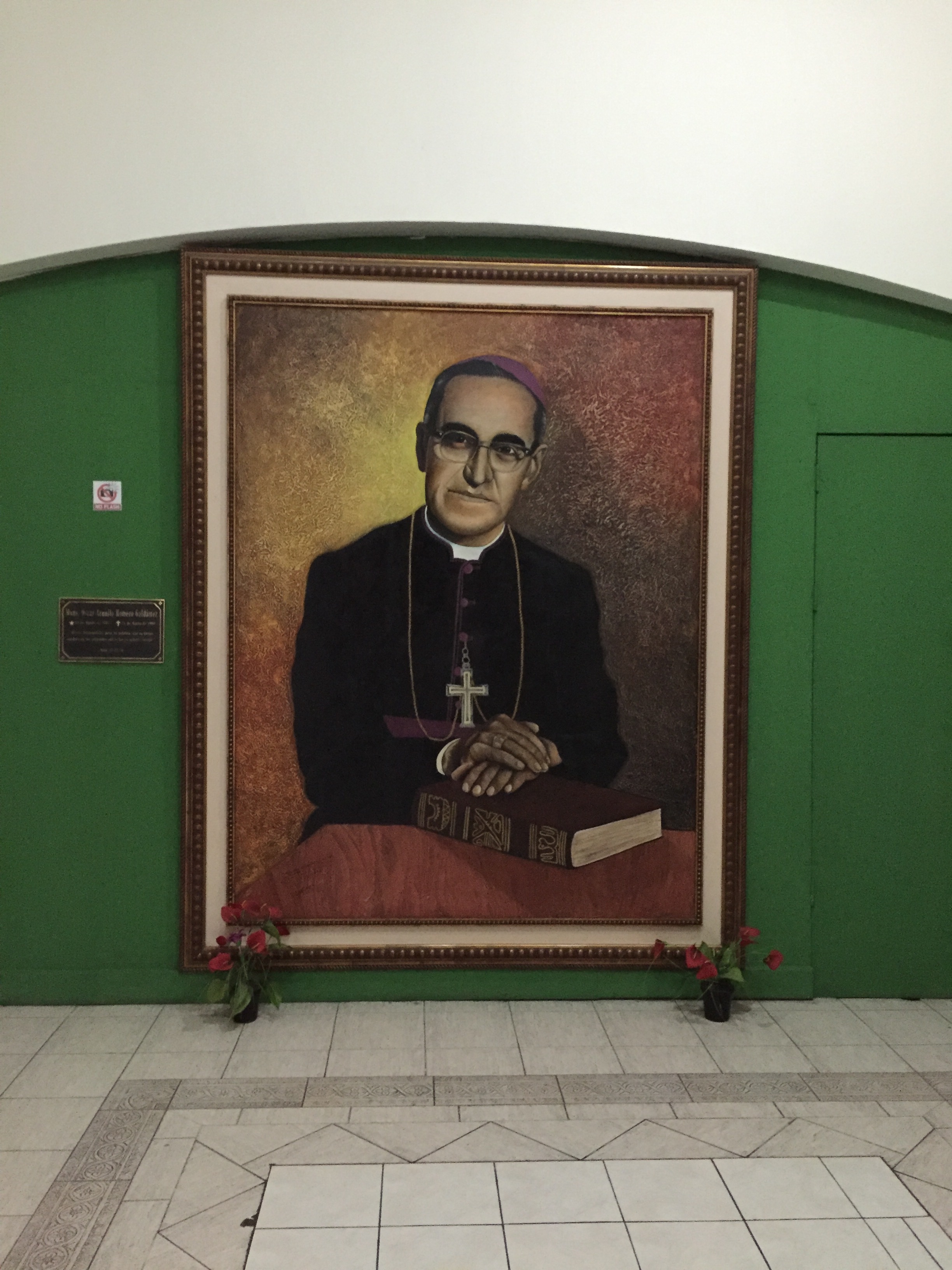
A painting of Archbishop Oscar Romero in San Salvador Cathedral at San Salvador Cathedral. Archbishop Romero outspokenly opposed social injustice, assassinations and torture, which were being practiced by an El Salvadoran military junta that took power in 1979. He urged the US government to stop sending aid to the junta. He was assassinated in 1980. Shortly afterward, the Salvadoran Civil War ensued.

Two Salvadoran girls descending the staircase of San Salvador Cathedral.

Children enjoying ice cream outside of San Salvador Cathedral.
A beautiful respite. I wasn't prepared for the exquisite beauty of our next stop, the Iglesia El Rosario (Rosario Church) in the city center of San Salvador. The church, built in 1971, was designed by sculptor Ruben Martinez, who no doubt intentionally understated the impact of the outside of the church, just to stun visitors when they enter the building. Once inside, you are surrounded by brilliant rainbows of natural light, which in some ways reminded me of Gaudi's Familia Sagrada in Barcelona, Spain.

The unassuming, rather drab concrete exterior of La Iglesia Romero in downtown San Salvador belies its brilliant interior (see below).

Cascades of natural light through stained glass windows in La Iglesia Rosario create an atmosphere that brilliantly transcends the dull, grey concrete exterior of the building.
Joya de Cerén, the Pompeii of MesoAmerica. The next day, we departed San Salvador to visit our first Mayan archeological site, Joya de Cerén. This UNESCO World Heritage site is known as "The Pompeii of MesoAmerica" because, like Pompeii, Italy this city was buried by an ancient volcanic eruption. The volcano erupted in 600 A.D., but apparently the inhabitants had just enough forewarning to escape, though they left almost all of their belongings behind. Some of the buildings, pottery, textiles and utensils were preserved beautifully. After the site was discovered and excavation begun in 1976, archeologists learned a lot about the social structure and culture of the ancient Mayans.

A beautiful ceramic urn on display at the museum of Joya de Ceren, an ancient Mayan city that was buried by a volcanic eruption in 600 A.D.

Mayan potters still use similar ceramic techniques as the ancient Mayan's, as shown by this Guatemalan woman above.
Next stop: Queztaltepec, an ancient volcano very near San Salvador. The last time it erupted in 1917, the huge lake that had formed inside of its crater known as El Boqueron was blown away and a nearby town was buried. We hiked to the rim of the crater, where today, farmers still till the soil. Trails leading up to the crater were beautifully forested and great bird habitat.
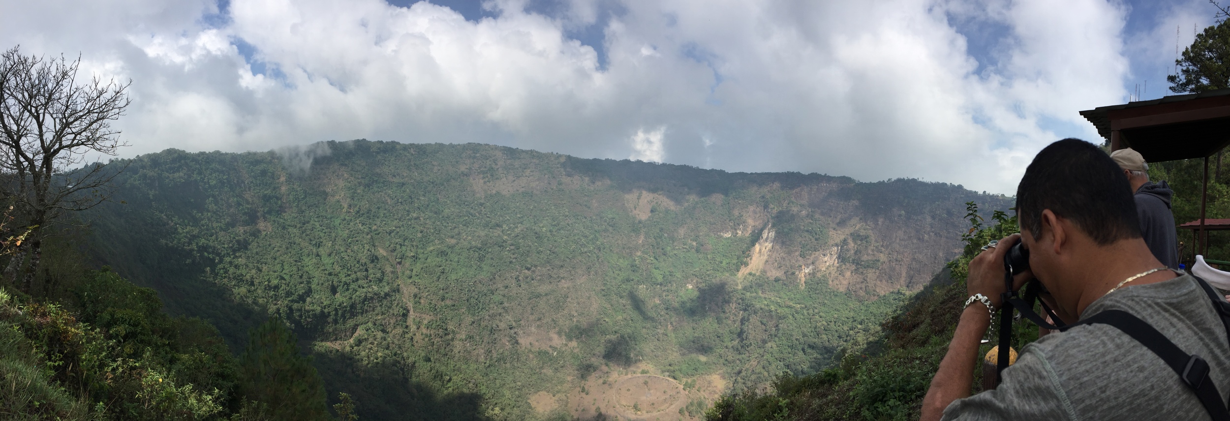
Looking out over the huge caldera of Quetzaltepec, an active volcano near San Salvador. This caldera known as El Boqueron (big mouth) used to hold a giant lake, which was blown away during the last eruption in 1917.
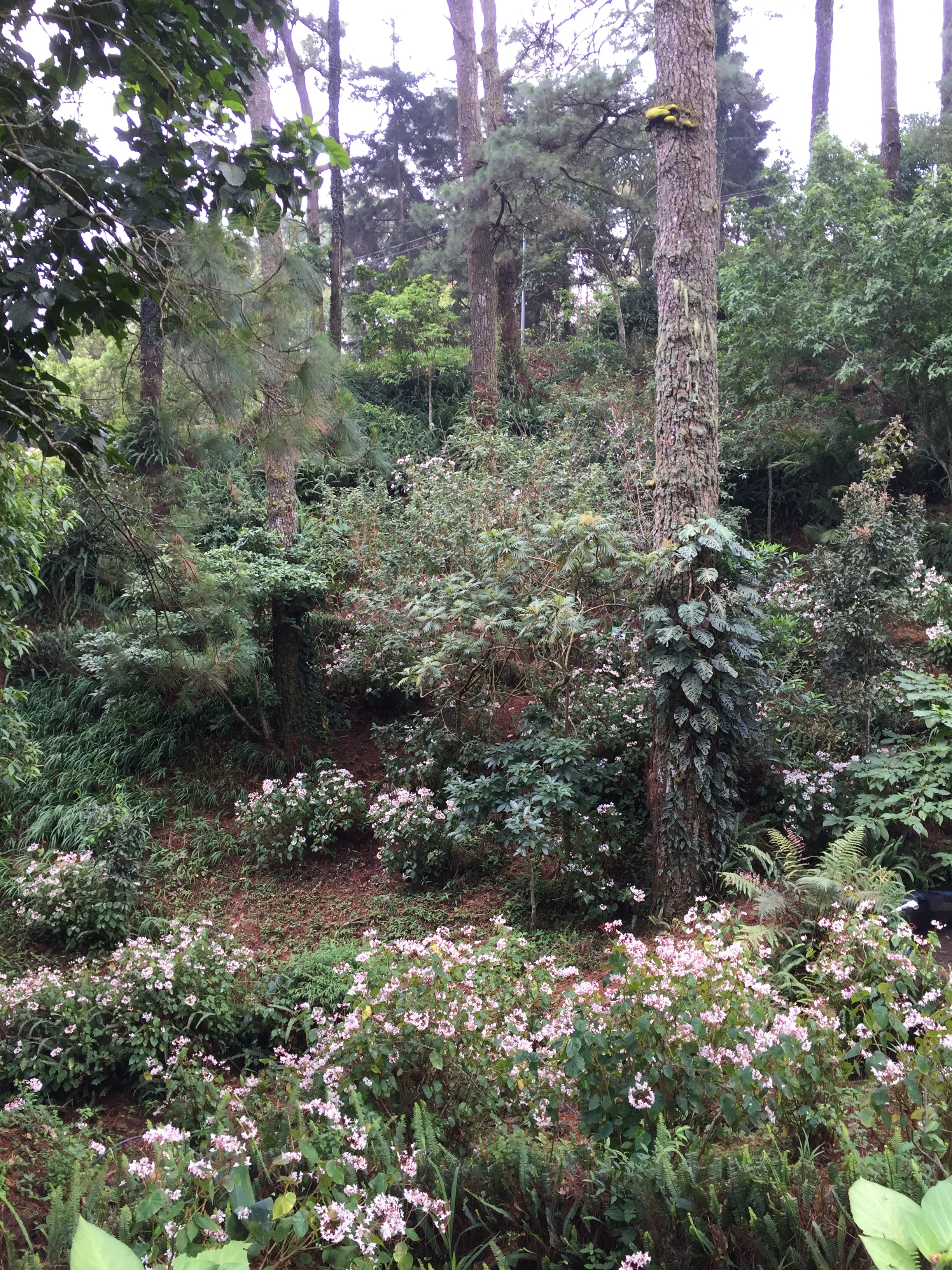
Lush tropical forests grace the trails leading to the rim of the crater of the volcano Quetzaltepec near San Salvador, El Salvador.
Honduras.
Next we set off for Honduras. We would drive north from El Salvador through Guatemala until we reached the road to the town of Copán Ruinas in Honduras. From there it was only a short drive to the famous Mayan ruins of Copán.
I didn't relish the idea of driving in Honduras after the murder of environmental activist Berta Cáceres, an indigenous Honduran woman who won the prestigious Goldman Prize in 2015. The prize was awarded for her grassroots work that eventually stopped the construction of the Agua Zarca dam by Chinese state-owned Sinohydro, the world’s largest dam developer (Goldman Foundation website [http://www.goldmanprize.org/recipient/berta-caceres/]. The Agua Zarca Dam was set to be built on the sacred Gualcarque River without consulting the indigenous people. This was a violation of international treaties governing indigenous peoples’ rights. The dam would have cut off water, food and medicine for hundreds of native people. Cáceres was instrumental in stopping it. Then she was murdered.
According to a recent New Yorker article about the Cáceres murder, Honduras is one of the most dangerous countries in the world for environmental activists. The non-profit Global Witness reports that "at least 109 people were killed in Honduras between 2010 and 2015, for taking a stand against destructive dam, mining, logging and agriculture projects, and the most perilous for environmental activists." [https://www.globalwitness.org/en/press-releases/global-witness-releases-new-data-murder-rate-environmental-and-land-activists-honduras-highest-world/]
It's important to remember while traveling abroad that environmentalists, journalists, and other outspoken people who draw international attention to environmental/human rights issues have been detained and sometimes imprisoned by governments that don't like having their policies and actions exposed and/or challenged.
I reminded myself that I was traveling as a tourist with a certified tour group, and that the Honduran economy depends on tourism. Still, according to OSAC, along the road to Copán, armed men have forced tourist buses off the road and robbed the victims, "occasionally assaulting the driver or passengers." Still, I put fear out of my head in anticipation of seeing Copán, one of the most spectacular of all Mayan archeological sites.
Who were the Maya?
The Maya were the Western Hemisphere's most advanced pre-Columbian civilization, thriving from around 200 A.D. to 900 A.D. during its Classic Period. Even after the decline of this advanced civilization, the Mayan people continuously remained in the same region intact as a culture even until today. The Maya invented a sophisticated writing system and an advanced mathematics system including the first recorded use of zero. They were skilled architects and builders, and invented an accurate calendar system based on their astounding knowledge of astronomy. They produced beautiful murals, sculpture, ceramics, textiles, and jewelry. So, they didn't use the wheel...nobody's perfect!
Copán, in western Honduras is one of the most sophisticated of all Maya sites in Mesoamerica. It was designated as a UNESCO World Heritage Site in 1980. Copán lies in the jungle where you can see and hear native macaws in the wild. I've posted some photos of Copán below:
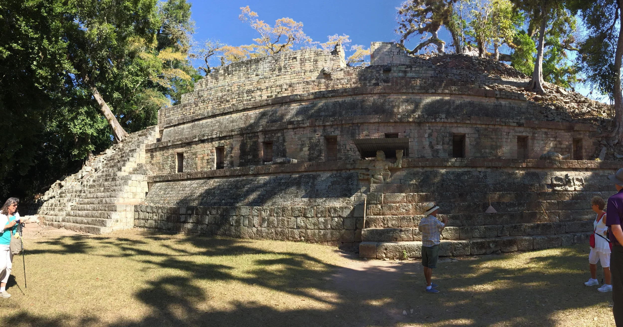
A palace at Copán, Honduras.

It's easy to imagine living here once upon a time in Copán and gazing out to the mountains beyond...

Stone carvings on a rock wall at Copán ruins in Honduras.

Trees would takeover the ruins at Copán if not for constant intervention.
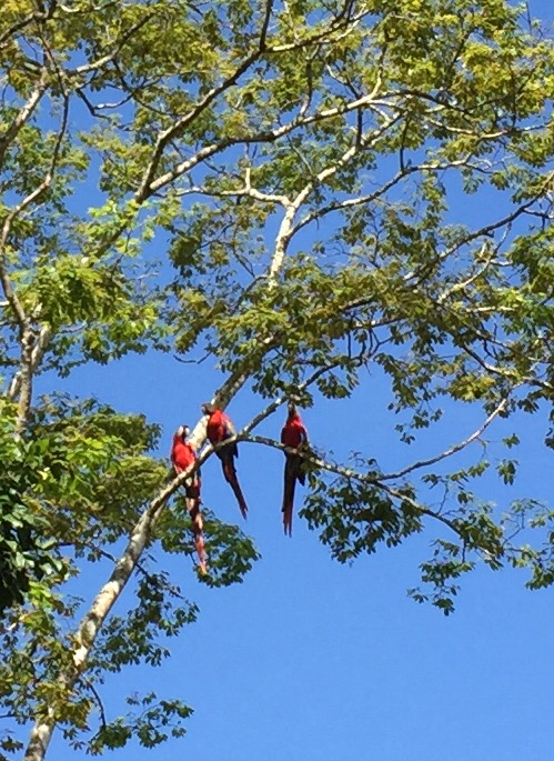
Macaws above entrance to Copán ruins in Honduras. . .and I thought bluejays were noisy!

A stelae sculture at Copán, Honduras.
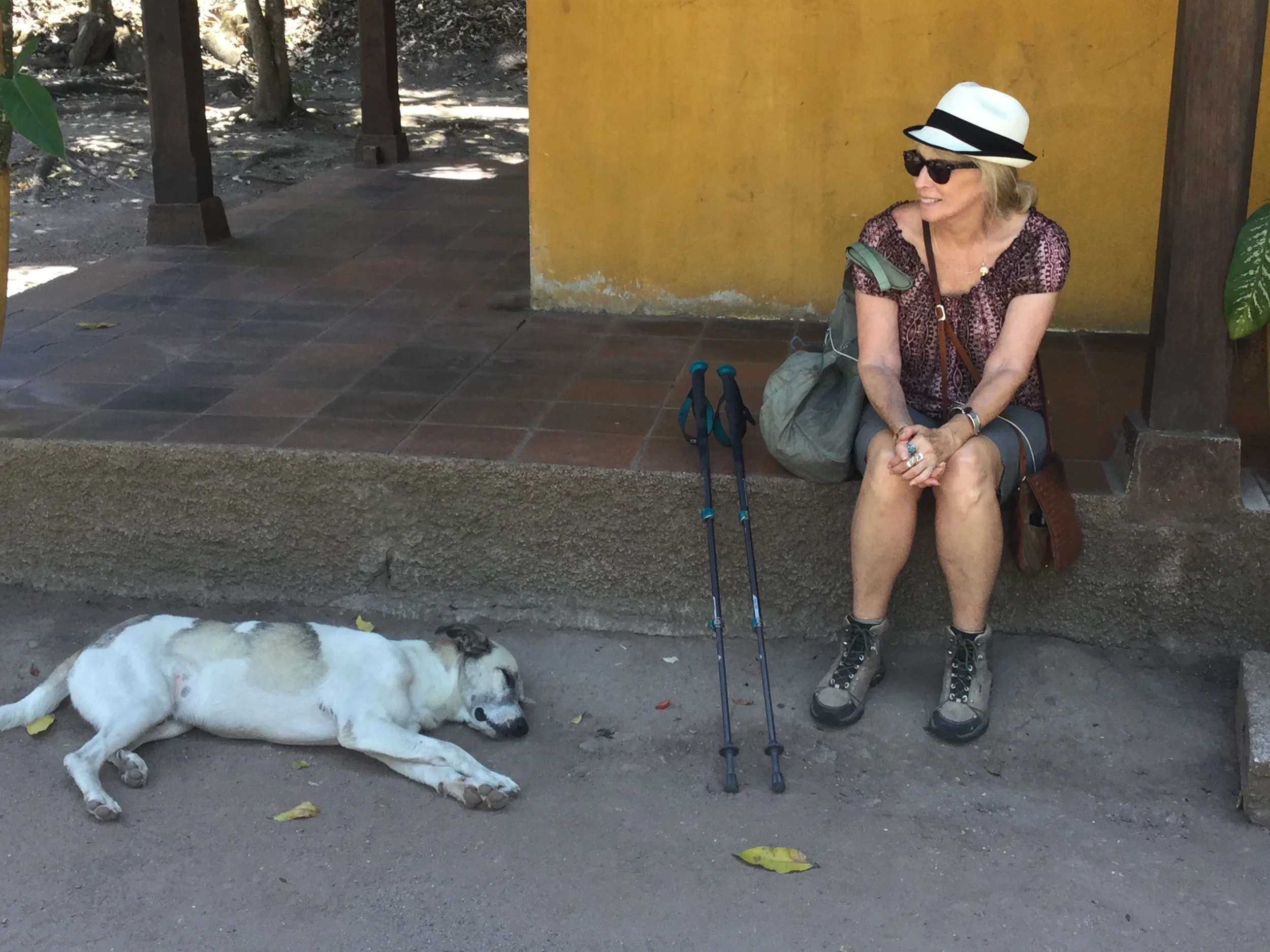
It got hot out here walking around Copán in the 90 degree heat...this pup's got the right idea.
While there's a lot to see at Copán, keep in mind that these buildings were constructed on top of other buildings, built by previous generations of Mayan rulers. While no longer open to the public, some of these underground excavations have given archeologists the information they need to portray what Copán looked like when it was occupied. All the stone walls of the buildings were plastered and painted brilliant colors. It must have been dazzling!

Ball court at Copán, Honduras.
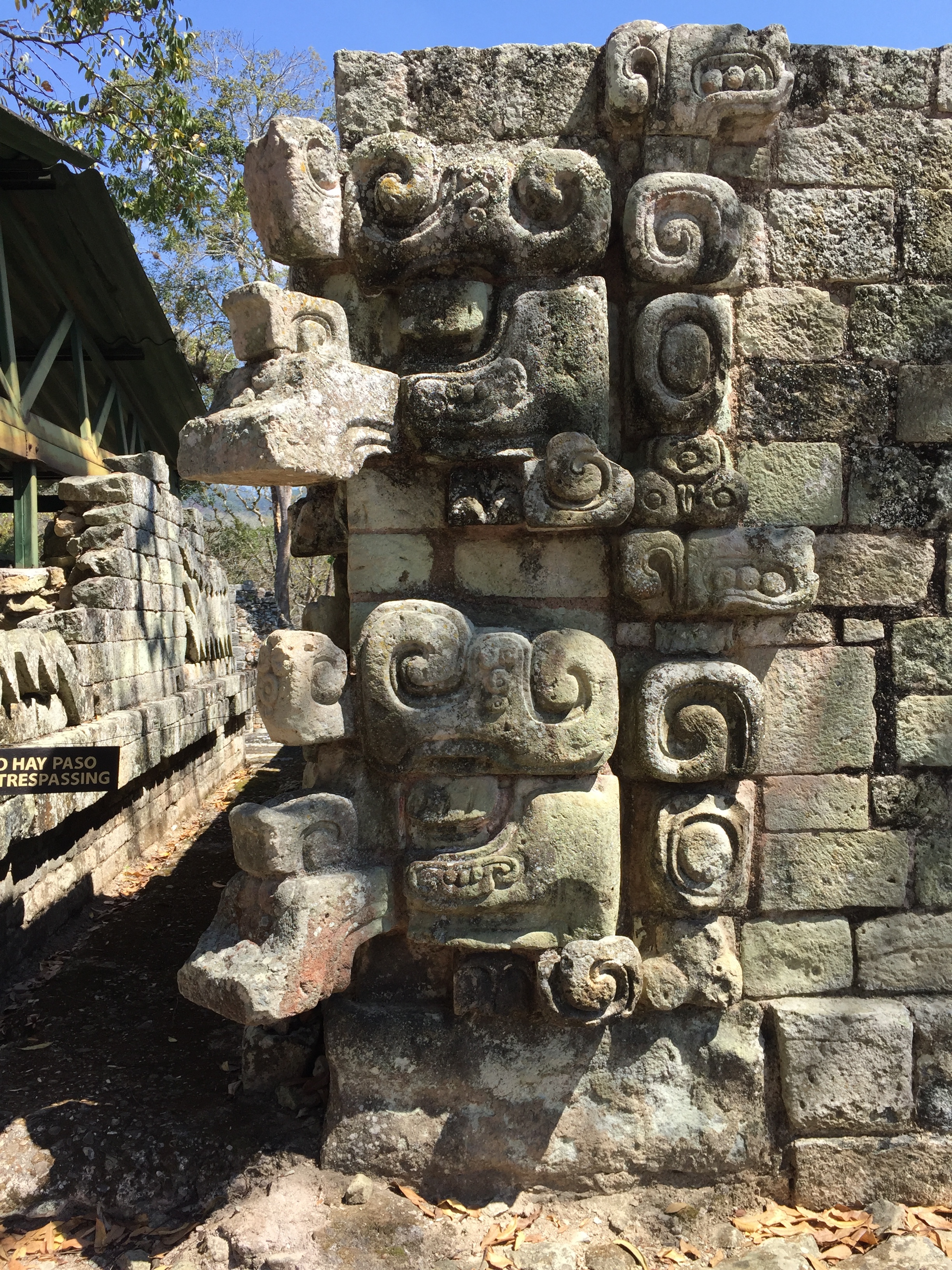
Close-up of stone carvings at Copán, Honduras.

Beautiful heiroglyphics carved on stone tablet, Copán, Honduras.
Guatemala.
Then, from Honduras, back to Guatemala and to Guatemala City . . . we drove through the Guatemalan countryside where we stopped to visit a coffee plantation.

Preparing coffee beans for roasting in the Guatemalan countryside outside of Guatemala City.
As we drove, we began to notice that we were being closely followed by a big, official looking SUV. When we stopped for lunch at a very friendly local restaurant, so did the SUV. Armed, uniformed men got out of the SUV and began eating their lunch. They resumed following us after lunch. When we asked our tour guide about this, he said they were the Guatemala Tourist Police. It was their job to make sure that tour buses, such as our smallish 16-passenger van, were protected from bandits.
According to OSAC, Guatemala has one of the highest violent crime rates in Central America: "Violent crime is a serious concern due to endemic poverty, an abundance of weapons, a legacy of societal violence, and weak law enforcement and judicial systems. The number of violent crimes reported by U.S. citizens and other foreigners has remained high, and incidents have included, but are not limited to, assault, theft, armed robbery, carjacking, rape, sexual assault, kidnapping, and murder, even in areas of Guatemala City once considered safe." [https://www.osac.gov/pages/ContentReportDetails.aspx?cid=17785; italics mine]
Guatemala's violent & unjust history.
I took note of the OSAC's phrase in italics above, "legacy of societal violence." To me, it's a euphemism for the genocide and other horrific injustices endured by the indigenous people of Guatemala ever since the Spanish conquest and continuing through the Guatemalan Civil War from 1960 through 1996. Ladinos (people of mixed Mayan/European descent) have also suffered greatly. During the civil war, the Guatemalan State sought to annihilate Mayan villages, destroy their culture and confiscate their land. More than 200,000 people were killed during this period. Most survivors had fled their villages to live in the mountains to escape being killed. One of my contacts in Guatemala explained how the government confiscated his parents' farm during the 1980s. As a young boy, he fled and lived in the jungle for 11 years until the Peace Accords in 1996 made it safe for him to return. Even then, the government never returned the farmland that they confiscated. Instead, his parents were awarded only a pittance of the value of their land.
Part of the peace accords directed the United Nations to organize a Commission of Historical Clarification (CEH). In 1999, CEH released its report, “Guatemala: Memory of Silence,” which documented the Guatemalan State's policy of genocide carried out against the Mayan people. You can read the detailed report here: [http://www.aaas.org/sites/default/files/migrate/uploads/mos_en.pdf]
Guatemala City
Guatemala City is the capital of Guatemala. It's divided into municipal zones representing a wide spectrum of society. The most infamous of these is Zone 3.
Guatemala City's Zone 3.
Zone 3, one of the city's poorest neighborhoods, is the site of the Guatemala City Garbage Dump, along with a desperately poor community that scavenges from the dump, searching for anything they can consume or resell. In the process, they are constantly subjected to toxic poisons and filth. Because of poverty, most of these people can't afford to go to school and most are illiterate. So there has been little hope for this community to improve their quality of life.

An entrance to the Guatemala City Garbage Dump, where an entire community in the city's infamous Zone 3 scavenges to make a living.

A main street in Zone 3, where the Guatemala City Garbage Dump provides the only source of income for residents.

A Zone 3 woman and her two daughters reselling scavenged items from the Guatemala City Garbage Dump.

A residence in Zone 3, Guatemala City.
Woman carrying a scavenged item from the Guatemala City Garbage Dump in Zone 3.
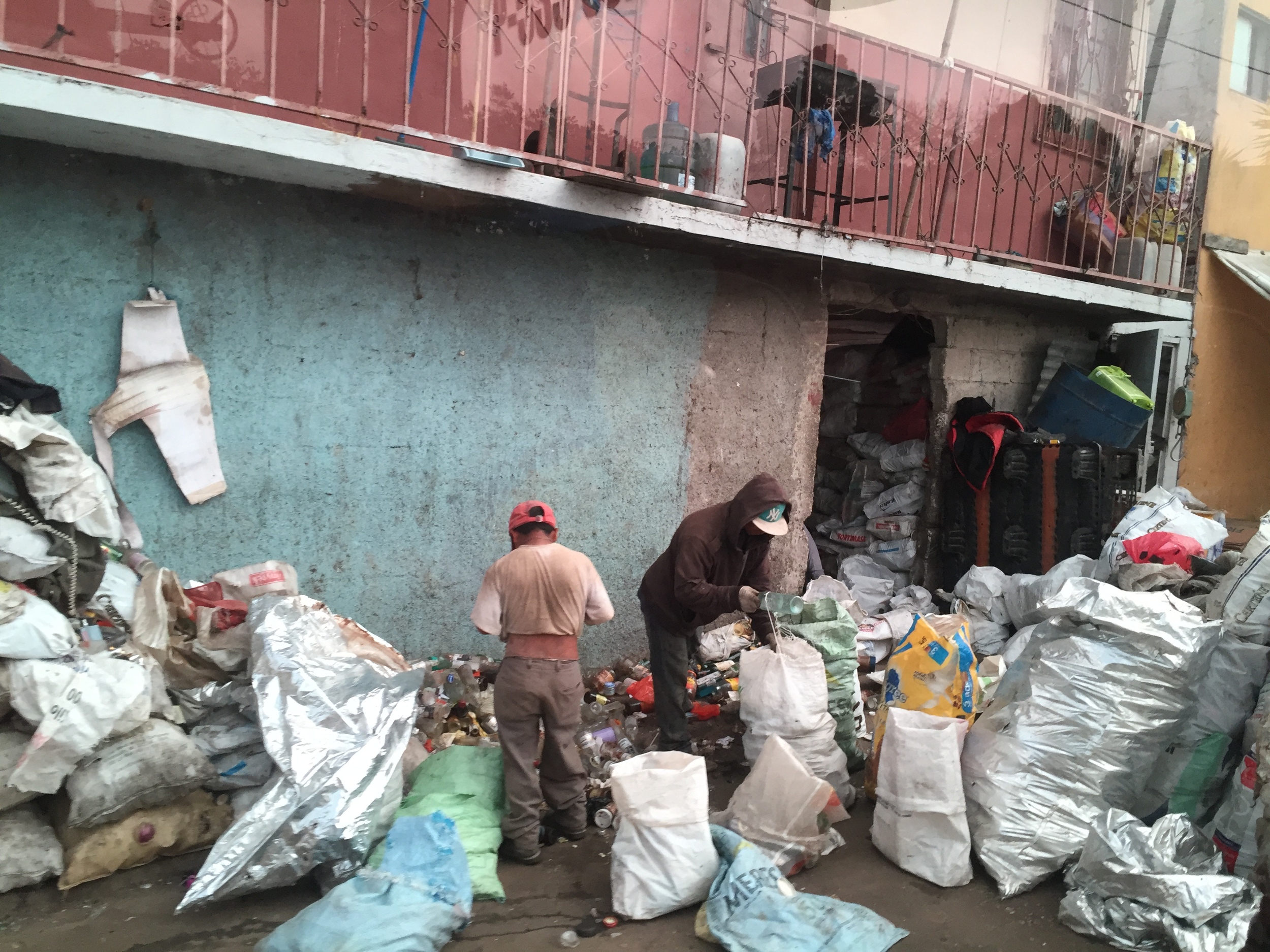
Men bagging recycables scavenged from the Guatemala City Garbage Dump.
Working for change in Zone 3: Safe Passage (Camino Seguro)
The story of Hanley Denning is a moving one. She was a young American woman who, during her visit in 1997, was so concerned by the plight of children working in the Guatemala City Garbage Dump that she sold all her possessions, relocated to Guatemala City, and started a school in Zone 3. Her vision was to remove the children from this unhealthy environment, put them in school in their neighborhood, and prepare them for a different way of life. Thus started Safe Passage or Camino Seguro, as it is known in Spanish. Though she was tragically killed in a car accident in 2007, her mission continues today. Safe Passage is a 501 c-3 [http://www.safepassage.org/].
Our tour visited the Safe Passage school in Zone 3. It was an inspirational day. I've posted some photos below:

Teachers and students at the Safe Passage School in Zone 3, Guatemala City.

Since Safe Passage built this school, children are no longer permitted to work in the Guatemala City Garbage Dump. Instead, 550 of them attend classes here, such as the kindergarten pictured above.
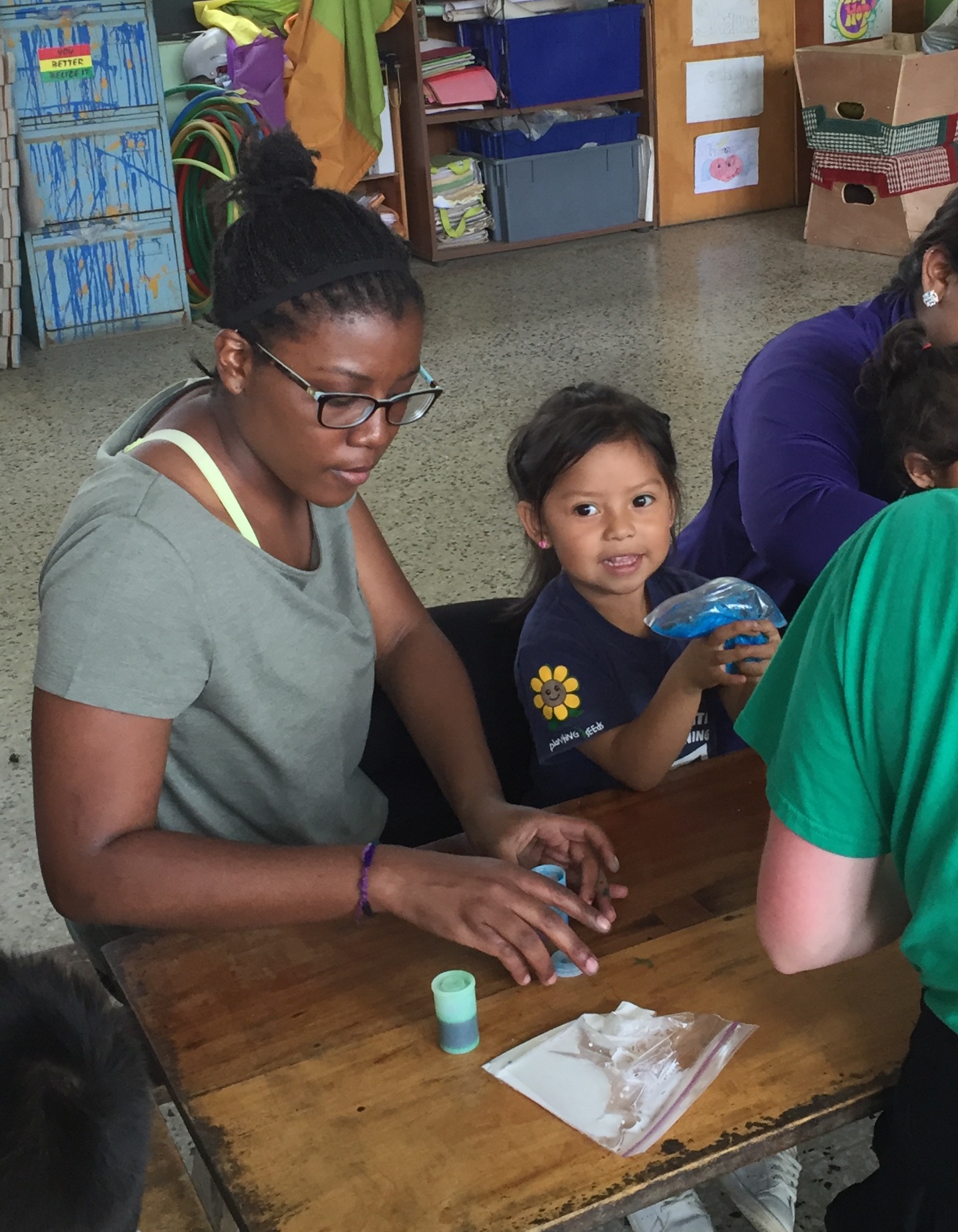
Volunteers from colleges and universities around the world come to Guatemala City to teach and assist at the Safe Passage School in Zone 3.

The fence around the Safe Passage school in Zone 3 in Guatemala City.
Outside Zone 3. Then we visited another side of Guatemala City, including down the Avenue Las Americas and the Plaza Berlin, and finally, a wealthy gated community known as La Cañada. It seems razor wire is everywhere, in both rich and poor communities. The city has one of the highest murder rates in the world.

A beautiful modern building in Guatemala City.
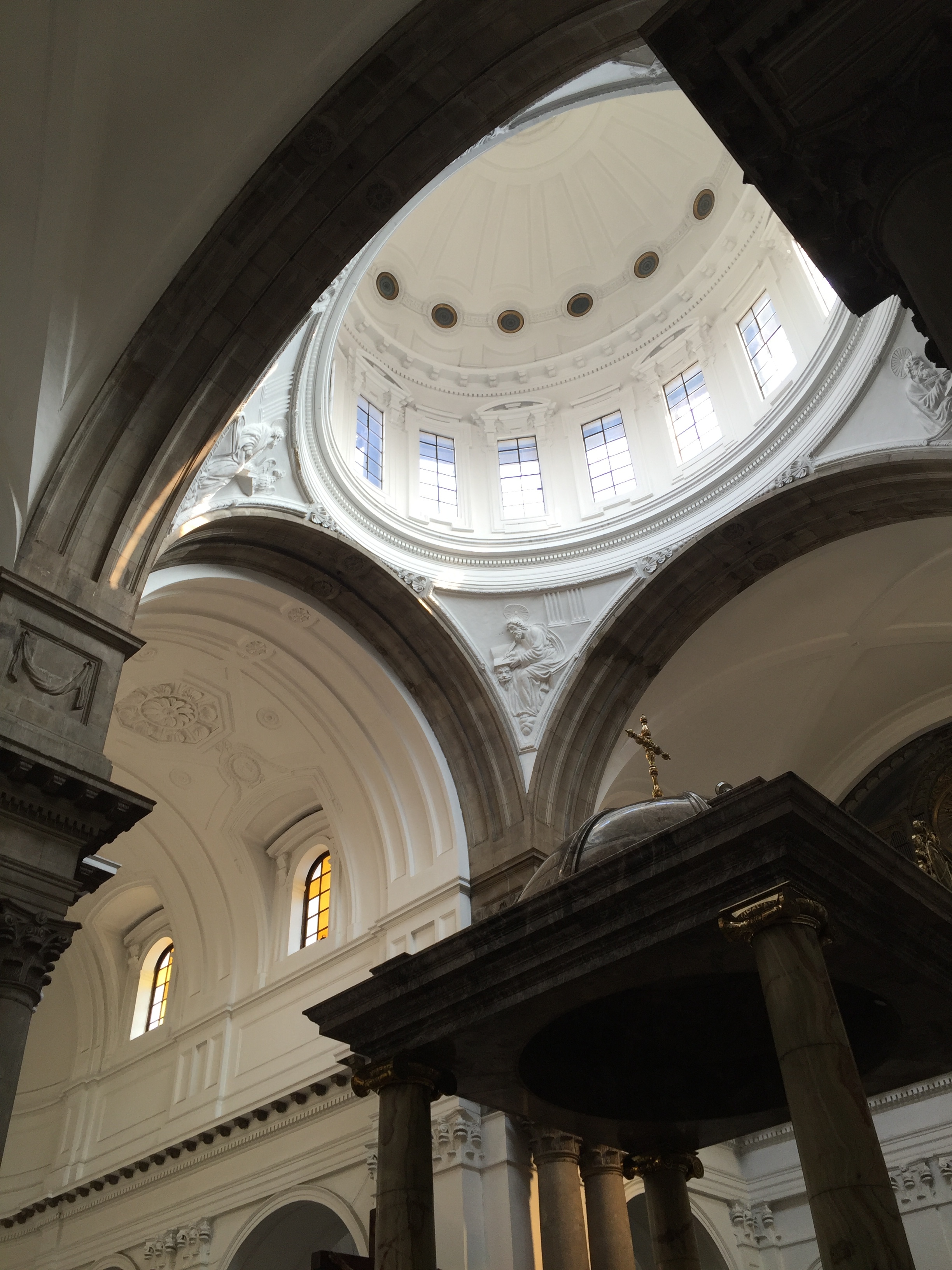
Inside the historic Metropolitan Cathedral in Guatemala City.

Good shopping day in Guatemala City...
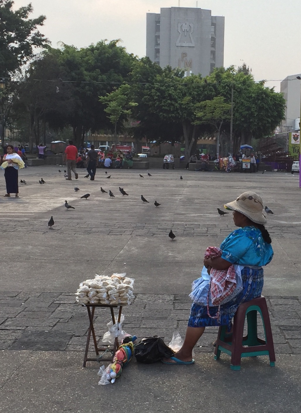
Street vendor in Central Plaza, Guatemala City.

This is me on the Avenue Las Americas, Guatemala City on Saint Patrick's Day...
As we left Guatemala City headed for Solala, a great Maya market town, we stopped to look at a brick factory in El Tejar.
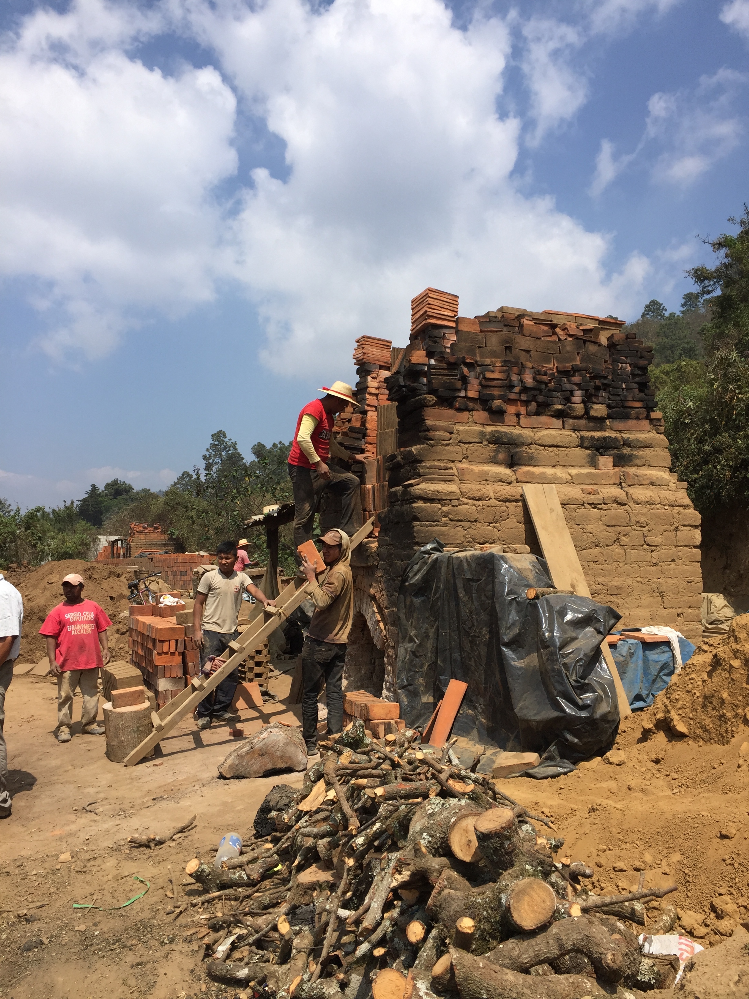
This is a small local brick-making operation along the road from Guatemala City to Panajachel known as El Tejar. The much sought-after adobe bricks are hand made and fired in small kilns.
When we arrived in Solalá, we walked through the central market, one of the busiest in all of Central America. This is an indigenous market. You won't find many tourists here...

Selling maize and beans in the Solala market.

A Mayan family enjoying market day at Solala.

A nut vendor in the plaza outside the Solala market.

A young Mayan girl in the Solala marketplace.
Onwards to Gringolandia.
The once quiet Mayan town of Panajachel or “Pana,” as the locals call it, is now very popular with North American tourists. Hence, it's part of what locals call "Gringolandia."
It's a great place to buy textiles, especially old huipils (blouses), which you can find if you look past the new, machine-made ones.

This woman in Pana sold beautiful old hand-woven textiles and hand embroidered huipils, like the one she is wearing. I bought one from her!
One reason for Solala's popularity with tourists is its proximity to Lake Atitlan, the deepest lake in Central America. The lake is surrounded by three volcanoes. To travel across the lake, you have to take a boat, since there are no roads around it. This fertile area was sthe heart of the Maya culture and it's still a center of traditional weaving. Just outside of Pana is the small village of San Antonio Paopo, where women have fromed a textile co-op.
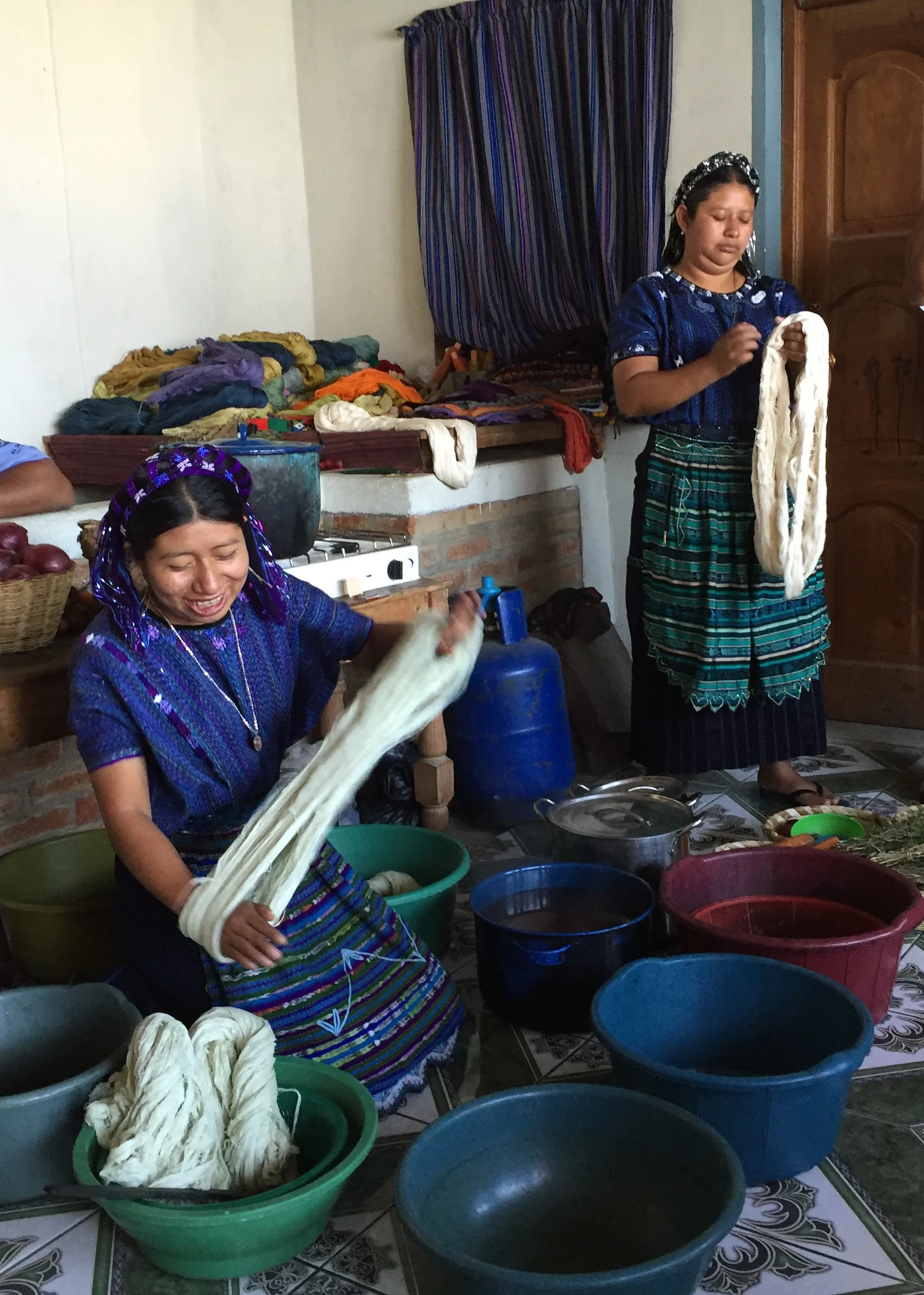
Women of the textile co-op at San Antonio Palopo, shown here using natural dyes to color the cotton before it is woven.
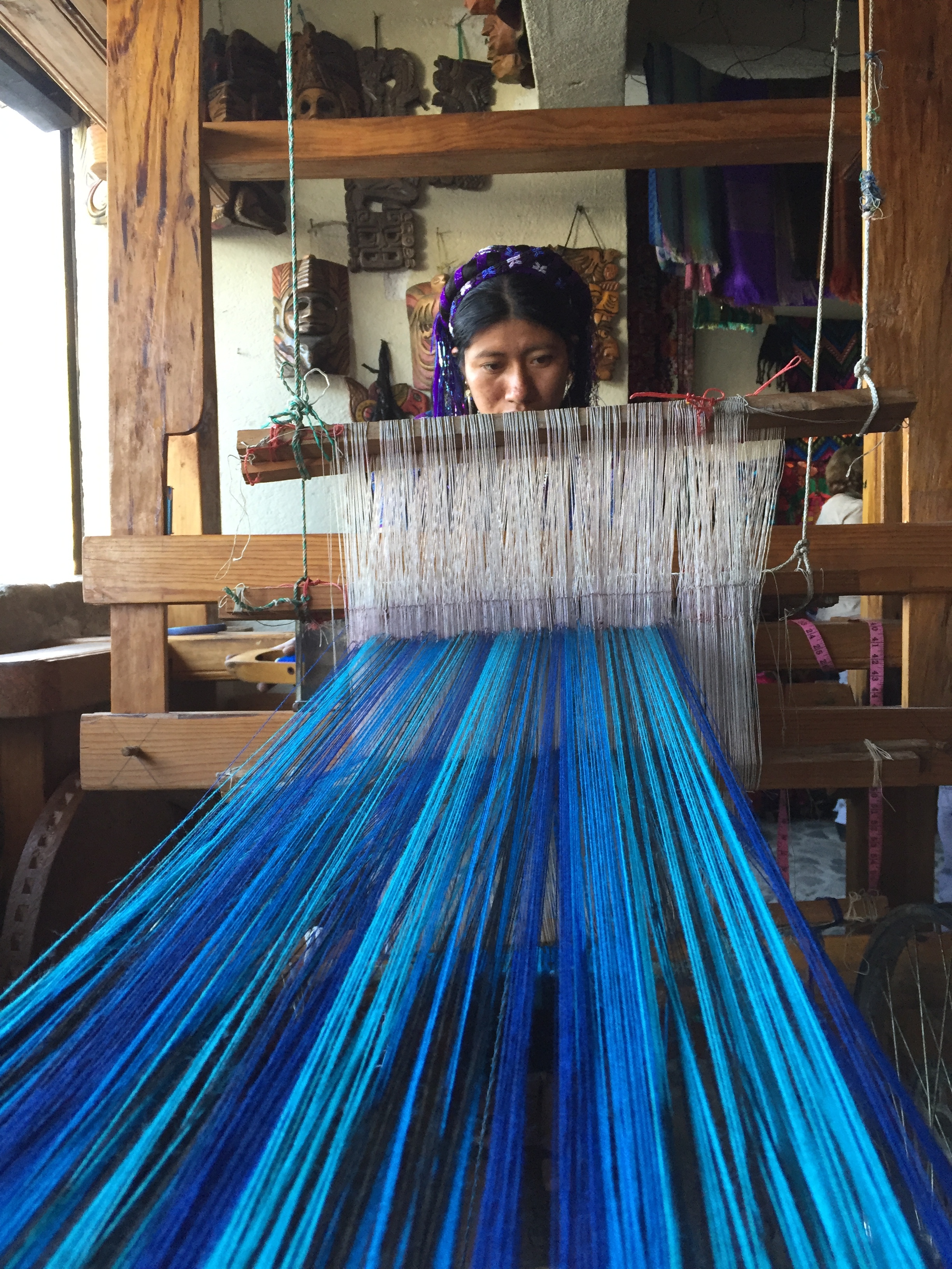
A woman in the textile cooperative in the village of San Antonio Palopo demonstrating Mayan weaving on a traditional loom.
Another popular tourist pastime near Pana is ziplining through the forests above Lake Atitlan.

That's me ziplining through a native forest outside Pana, enjoying a terrific view of Lake Atitlan.
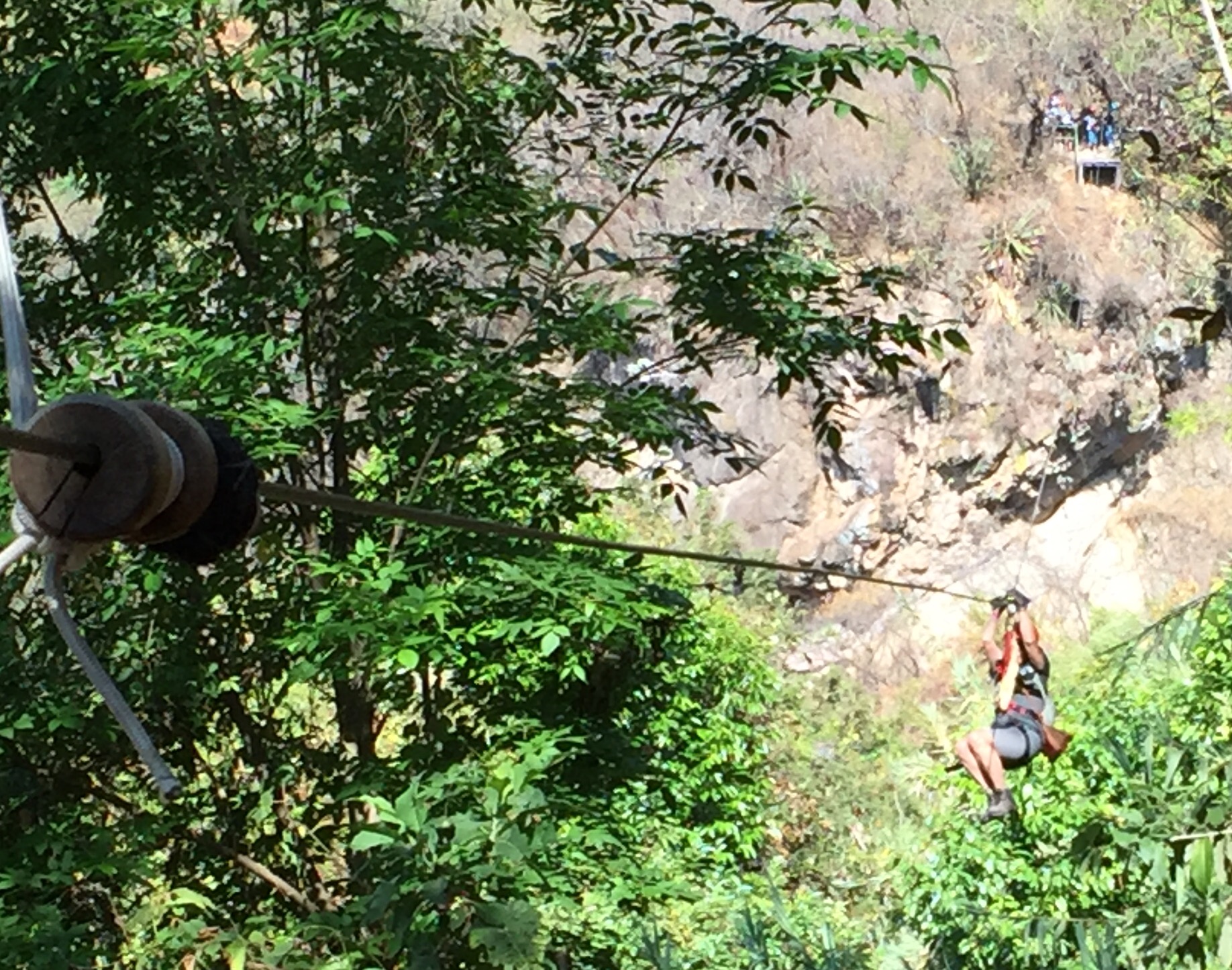
That's me again, ziplining through the forest above Lake Atitlan.
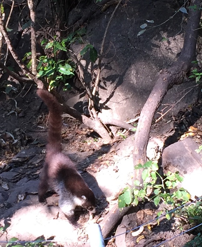
Hiking up the trails through the forest around Lake Atitlan, we spotted many koati mundis, which are part of the raccoon faily and native to Latin America.
There is some wonderfully fertile farmland along the edge of Lake Atitlan.

Vegetable farm along the edge of Lake Atitlan...you can see volcanoes in the background.
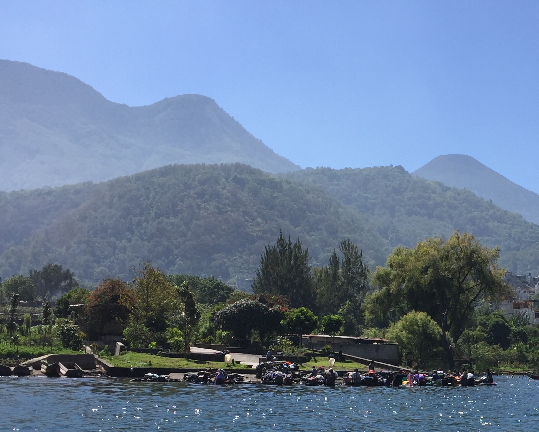
Cruising past a throng of women doing laundry on the side of Lake Atitlan.

A family in the village of Santiago Atitlan, across the lake from Pana.
Antigua, Guatemala during Semana Santa.
Our tour group was very lucky to be in the historic and beautiful city of Antigua during the week before Easter to watch the famous processions of Semana Santa. Antigua was the old seat of the Spanish colonial government of Central America beginning in 1534. It remained the capital of Guatemala until the 1700s when Guatemala City became the capital.

A "chicken bus," which is basically a souped-up, hot-rod update of an old, recycled American school bus. We're told these buses are refitted with Caterpillar engines and manual transmissions, and their garrish paint jobs & chrome trim rival any low-rider car. chicken buses are the main mode of transportation in Guatemala.
The week before Easter, people are arriving from other parts of Guatemala on "chicken buses" (see photo above), locals are out on the streets, creating brightly colored sawdust "carpets" which a a traditional art form this time of year. Antigua is exceedingly beautiful, and its status as a UNESCO World Heritage site, keeps it that way. All the streets in Antigua are cobblestone, and there are countless old stone buildings with tile roofs and walled gardens.

TWo Mayan women walking along a city street in Anitigua...note the cobblestone street.
Several active volcanoes surround Antigua. One erupts many times a day, usually appearing as little more than a puff of smoke. We hiked up a trail to Cerro de la Cruz above Antigua just before sunset to witness Volcano de Aguain erupting.
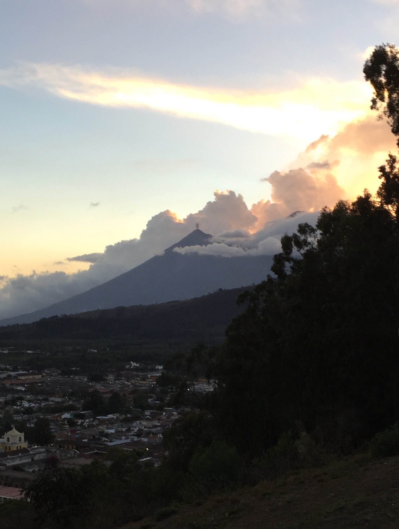
View from the Cerro de la Cruz above Antigua, as Volcán de Aguain erupts just after sunset.
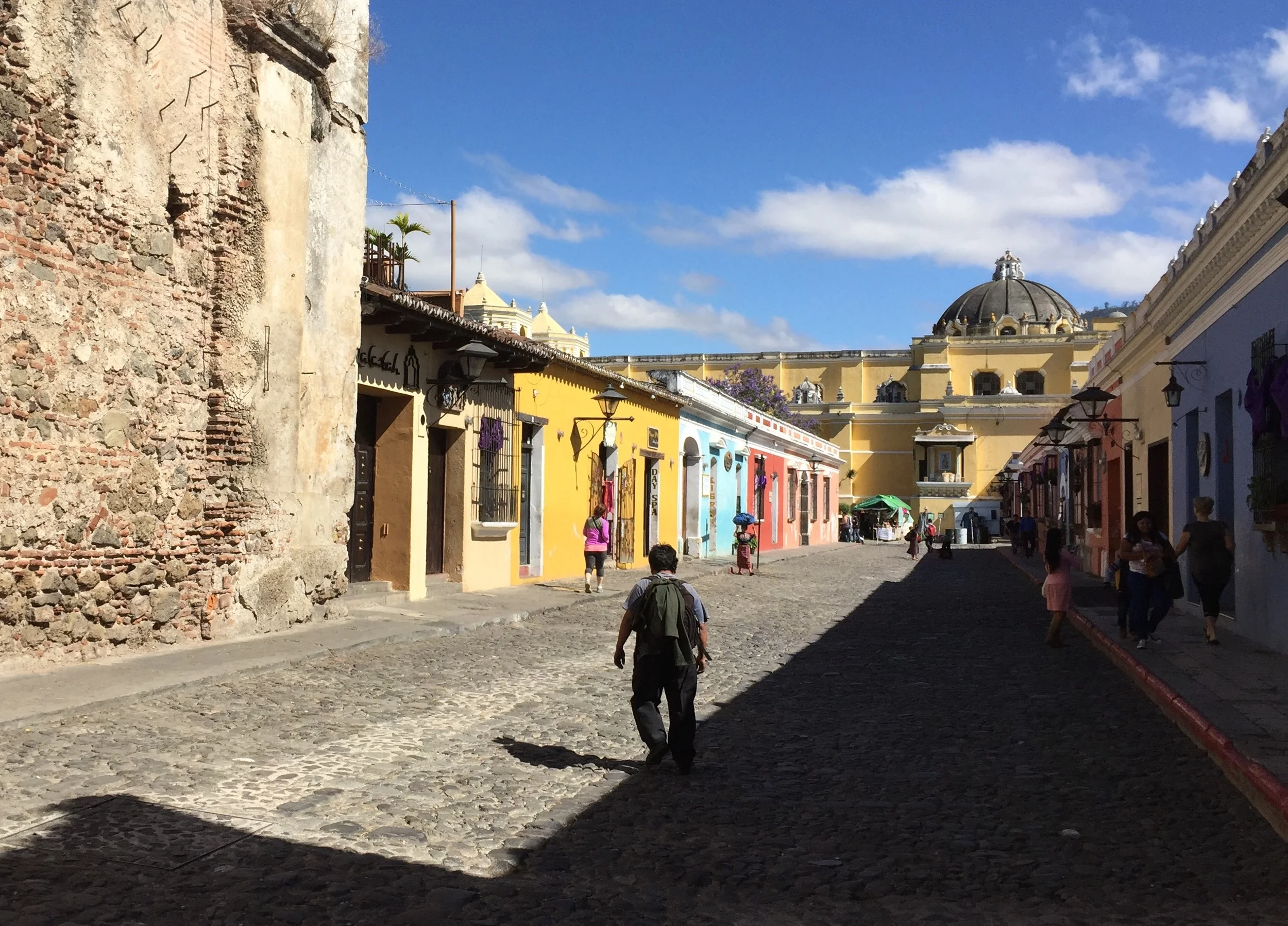
Typical cobblestone street in Antigua, Guatemala.
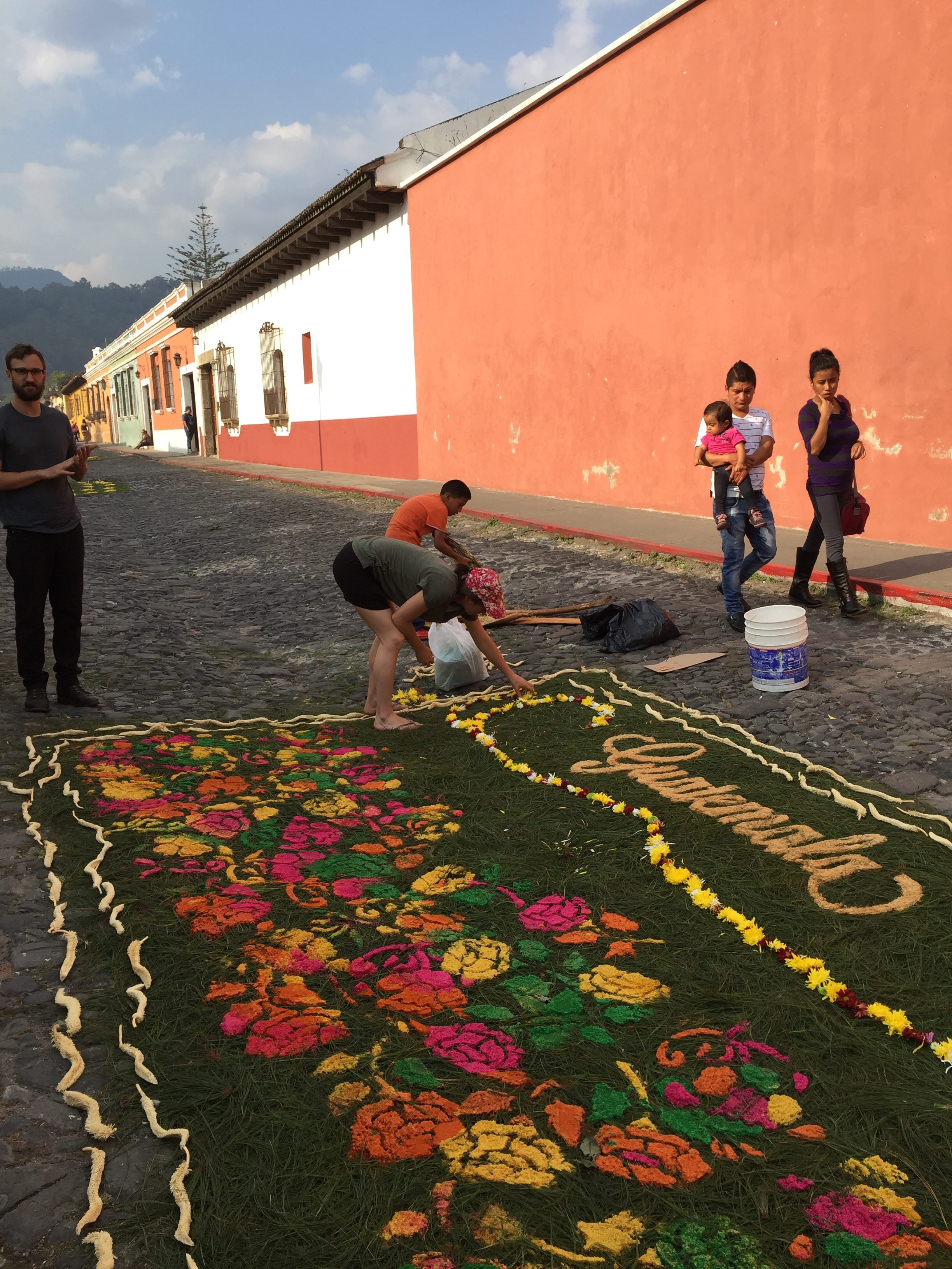
Locals join tourists in creating traditional sawdust carpets, which cover the sstreets of Antigua during the week before Easter.

Just hours before the Easter processions are to begin, the clouds open up to let the sun rays through.

Robe clad processioners walking along the cobblestone streets, next to flower-strewn sawdust carpets.

Semana Santa procession in full swing.

Young participant in the Semana Santa procession, Antigua, Guatemala.

A local church decorated in traditional style for Semana Santa week. Note the sawdust carpet and the cornucopia of fruits and vegetables.
Crowds are out during Semana Santa week, and you can purchase candles to make an offering in many of the local churches.

Candles available for purchase at the entrance to a local church in Antigua, Guatemala.

Here, you can see the Volcáno de Aguain through the famous archway in Antigua's central area.
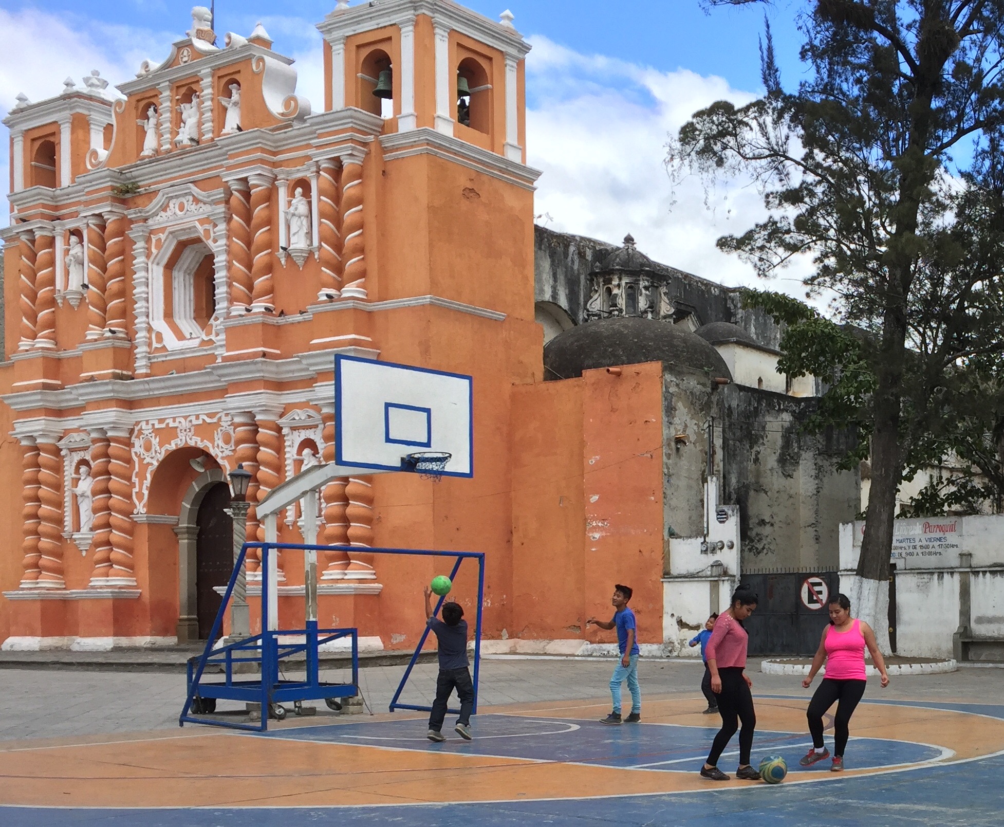
Kids playing basketball in front of the old convent in Antigua, Guatemala.

Beautiful old stone wall inside the grounds of a walled garden in central Antigua.

Historic Antiguan kitchen as recreated in the museum in central Antigua.
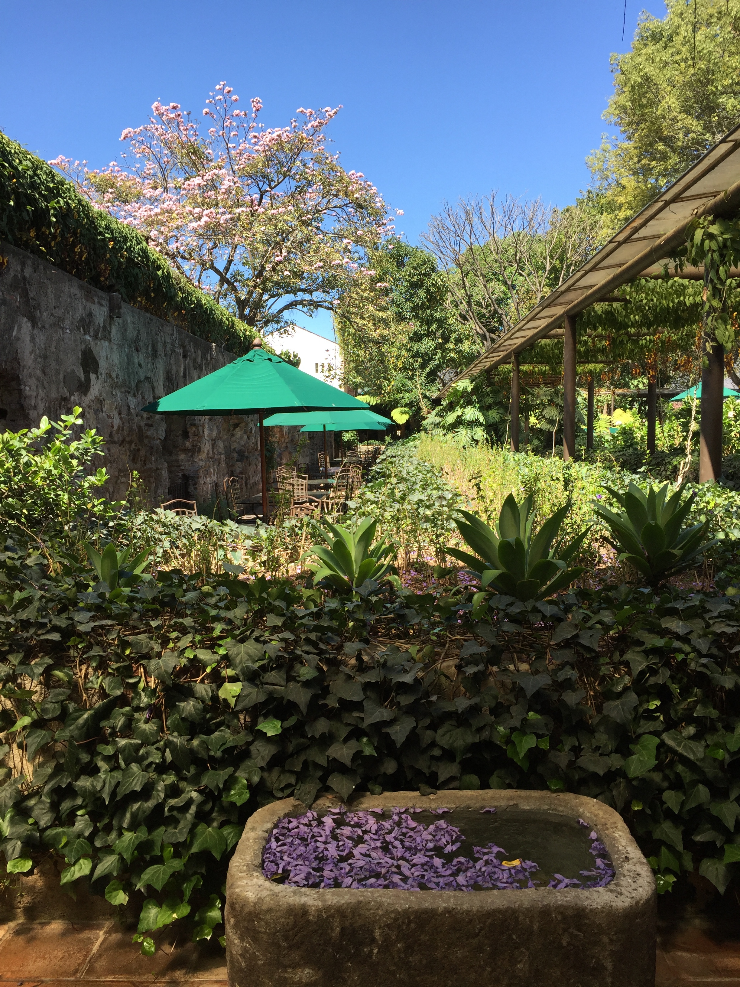
Anoterh scen insie an old walled garden in Antigua.

Hibiscus flowers are abundant throughout Antigua, Guatemala.
After four days in this beautiful city, we left Antigua bound for the fabulous archeological site of Tikal, in the jungle of Peten in northern Guatemala.
The ruins of Tikal.
Tikal, another UNESCO World Heritage Site was, some 1,800 years ago, home to an estimated 100,000 Maya.

Near the entrance to Tikal National Park, our guide points across the jungle to the tallest ruin of Tikal,

Panoramic view of the main plaza of Tikal.

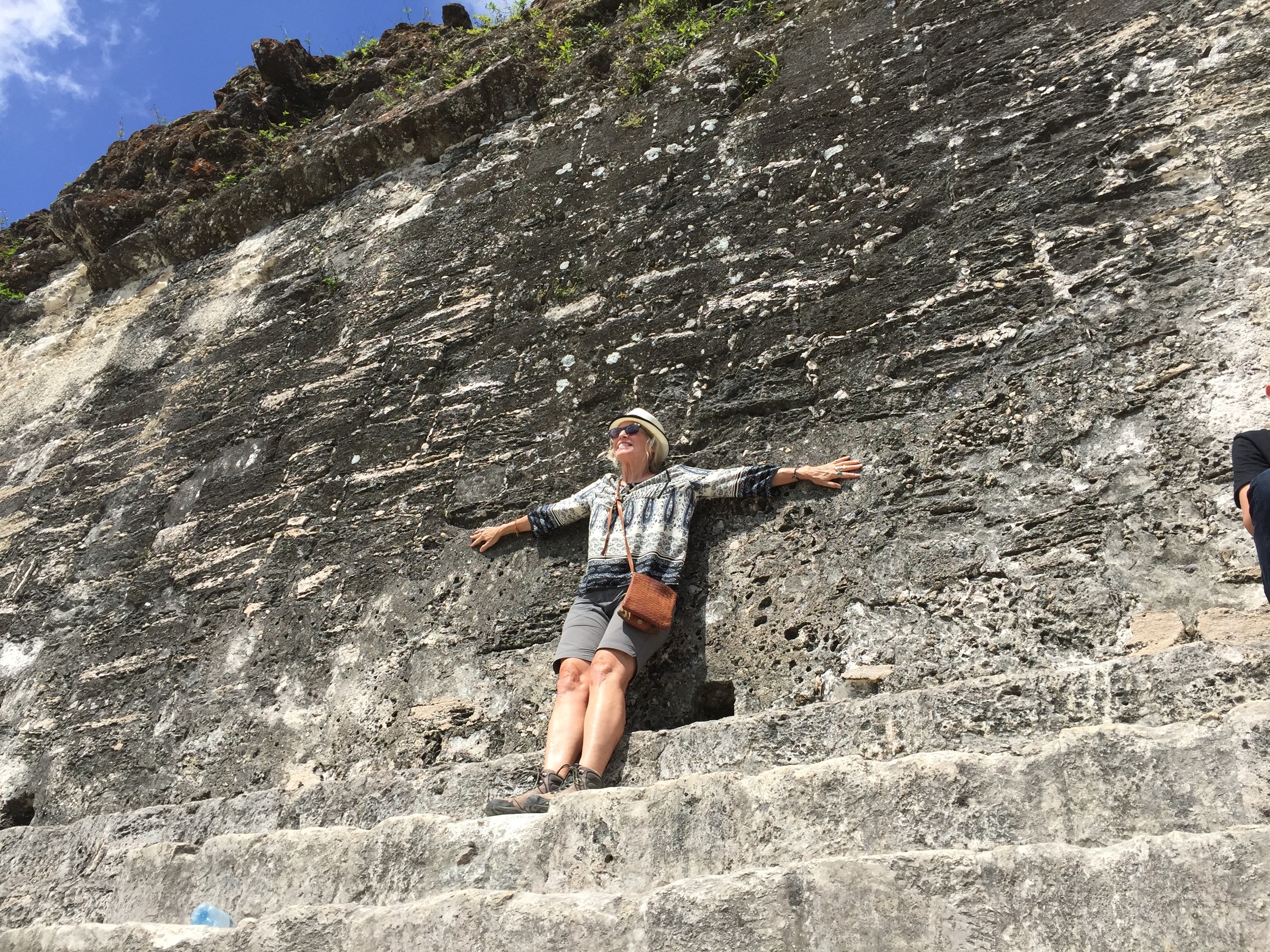
That's me taking a break in the shade overlooking the main plaza of Tikal.
There are some 3,000 buildings over approximately six square miles at Tikal, which iies within the jungle and hosts a noisy variety of native wildlife, most evidently howler monkeys.

Temple of the Jaguar.
Ecstatic appreciation of Tikal.
When we left Tikal, we still had Yaxhá to look forward to...this is where Survivor was filmed. It was fabulous hiking to the top of this ruin and peering out over the canopy of the jungle.
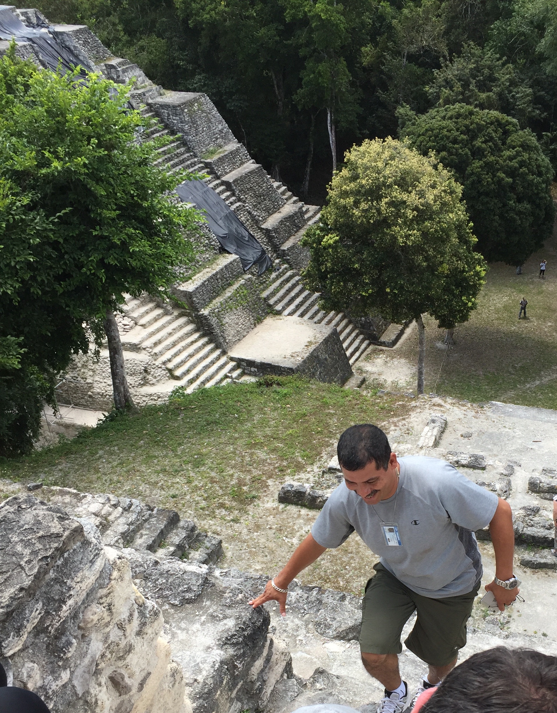
Our guide just before he reached the top of the ruin at Yaxhá
Maya Biosphere Reserve.
Both Tikal and Yakha are inside the vast Maya Biosphere Reserve, a government managed tropical forest reserve in Guatemala that 's bigger than Yellowstone National Park. The biosphere hosts many native species including thejaguar, puma, ocelot, margay, spider monkeys, howler monkeys, tapirs, crocodiles, harpy eagle, scarlet macaw, and fresh water turtles. Native forest trees include mahogany, Ceiba, and cedar. The biosphere reserve model, implemented by UNESCO, seeks to protect native forests, while attaining a balance between protection and human activities.
Belize and the Lamanai Ruins.
I spent the last few days of my trip in Central America and of my year-long trip around the world in Belize. Our tour would stay in the uninspiring Belize City, and take day trips to the Mayan ruin Lamanai , which means “submerged crocodile” in Mayan. The only way to get to Lamanai is by boat through the jungle on the New River. It was a fun trip...on a speed boat, with lots to look at.

We saw an amazing assortment of birds and even a few crocodiles on our boat trip down the New River to visit the 3,000-year old Mayan ruins of Laminai, Belize.

This tree overhanging the New River near Laminai ruins in Beiize is festooned with a snake cactus . . at first I thought it was a huge green snake.

The largest excavated ruin at Laminai, the Mask Temple.
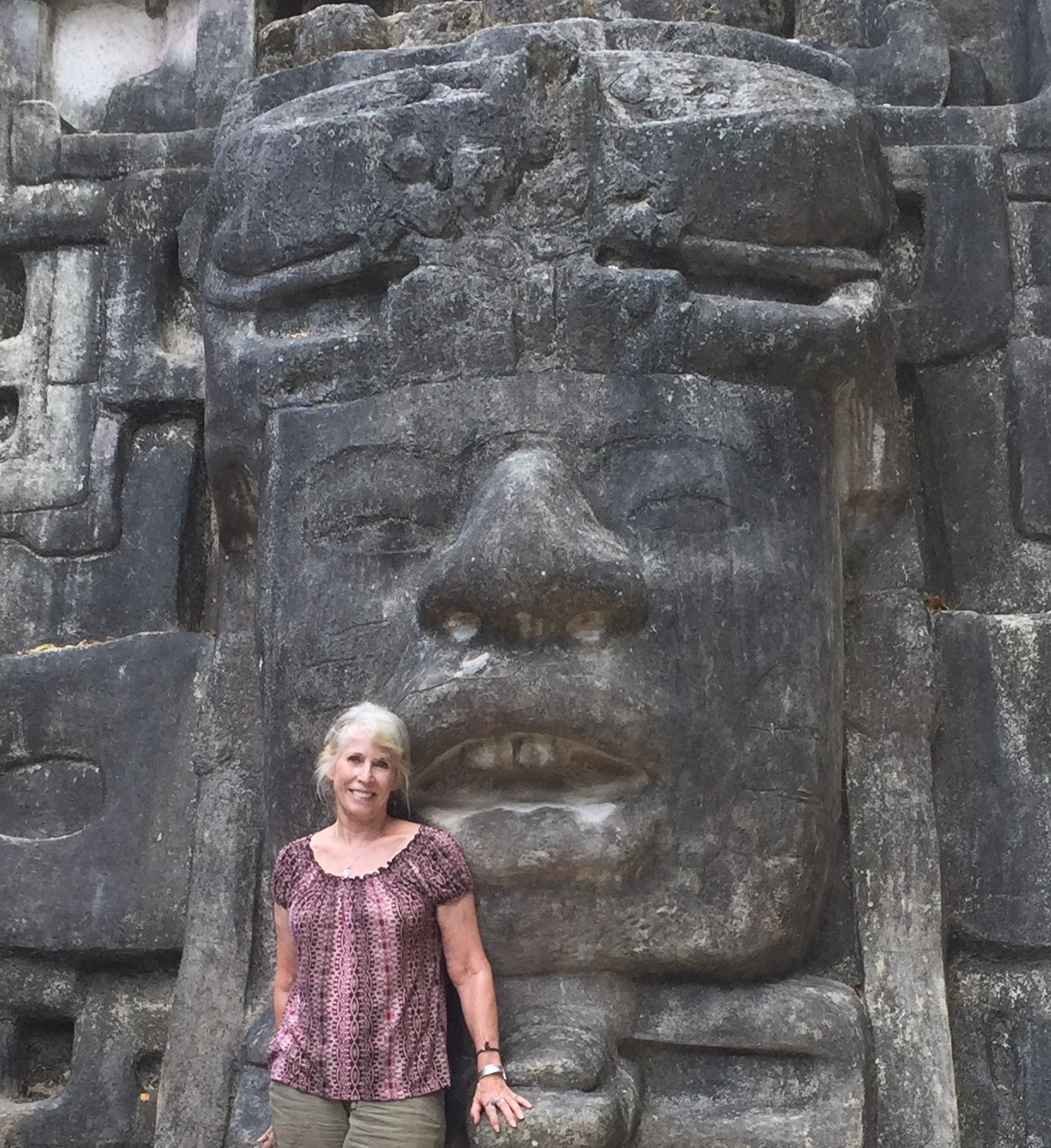
That's me in front of a massive stone carving at Laminai in Belize. Only a small fraction of the buildings of this site have been excavated.
The end of my journey.
The next day, our tour group left Belize bound for the USA. I could hardly believe I was about to re-enter Santa Cruz, California after an entire year of traveling around the world. I think my next blog will have to be entitled, "Re-entry!" 'Til then...